 terravel
Chad · Africa
Tibesti Mountains

What is Tibesti Mountains, and where is it?
The Tibesti Mountains are a volcanic range spanning 100,000 square kilometers across the central Sahara, primarily in northern Chad with a small portion in southern Libya. Emi Koussi, the range's southern peak at 3,415 meters, is the Sahara's highest point. Five major volcanoes with calderas and active geothermal features dominate the landscape.
Location and Scale in the Sahara
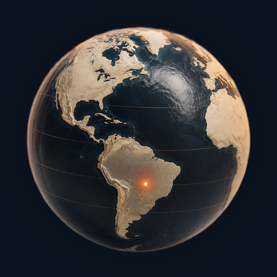
The Tibesti Mountains occupy the heart of the Sahara, roughly 1,000 kilometers north of Chad's capital N'djamena and 1,500 kilometers south-southeast of Tripoli. The range forms a large triangle with sides of 400 kilometers, spanning 480 kilometers in length and 350 kilometers in width. It sits approximately halfway between the Gulf of Sidra and Lake Chad, just south of the Tropic of Cancer, and represents the largest mountain range in the Sahara Desert.
The range straddles the Chad-Libya border, with the volcanic core and highest peaks located entirely in Chad. Sixty percent of the Tibesti's area exceeds 1,500 meters in elevation, with an average elevation around 2,000 meters. The northern slope drops sharply as a cliff overlooking the Serir Tibesti, a vast Libyan desert pavement, while the southern, southwestern and eastern slopes rise gradually from surrounding desert plains.
Five Volcanoes and Their Calderas
The central third of the Tibesti consists of five shield volcanoes with broad bases reaching up to 80 kilometers in diameter. Emi Koussi anchors the southern end at 3,415 meters. Tarso Toussidé rises to 3,296 meters in the west, while Tarso Yega, Tarso Voon, and Tarso Toon complete the group. Several peaks are crowned by massive calderas—Tarso Yega contains the largest at 19 to 20 kilometers in diameter and approximately 300 meters deep, while Tarso Voon's caldera plunges roughly 1,000 meters deep with a diameter of 12 to 13 kilometers.
Four large lava dome complexes between 1,300 and 2,000 meters high occupy the central mountains: Tarso Tieroko, Ehi Yéy, Ehi Mousgou, and Tarso Abeki. These structures now appear inactive, though the Smithsonian Institution records Holocene activity. Tarso Toussidé remains active, having erupted within the past two millennia. Its crater, Trou au Natron, measures 8 kilometers in diameter and 768 meters deep, with visible gas emissions from fumaroles when evaporation is low.
Active Geothermal Features and Mineral Deposits
Despite their age, the Tibesti Mountains retain active geothermal systems. The Soborom geothermal field on Tarso Voon's northwest side contains mud pools and fumaroles venting sulfuric acid that has stained surrounding soil in bright colors. The Yi Yerra hot springs on Emi Koussi's southern flank discharge water at 37 degrees Celsius. A dozen additional hot springs at Soborom emerge at temperatures ranging from 22 to 88 degrees Celsius. These features indicate that the earth's restlessness in the Tibesti has never fully ceased.
Mineral-rich deposits accompany the geothermal activity. Natron and sulfur accumulate in crater basins and around fumaroles. Carbonate deposits in the Trou au Natron and Era Kohor craters represent more recent volcanic activity. The volcanic area covers roughly one-third of the total Tibesti range and accounts for between 5,000 and 6,000 cubic kilometers of rock, with lava flows blanketing ancient Paleozoic sandstone across vast plateaus.
Volcanic History Spanning Millions of Years
Continental hotspot activity began during the Oligocene epoch and continued sporadically until the Holocene, meaning some Tibesti volcanoes were still erupting while human civilizations developed elsewhere on Earth. The basement consists of Precambrian granite, diorite and schist, overlaid by Paleozoic sandstone. Volcanic rock dominates the peaks, with most dating from the Lower Miocene through the Pleistocene and, in places, to the Holocene. Early eruptions created trap basalt formations extending tens of kilometers and stacking up to 300 meters thick.
Six distinct volcanic phases shaped the range. The first phase uplifted the Precambrian basement and formed early structures like Tarso Abeki and Tarso Tieroko. Subsequent phases shifted volcanic activity northward and eastward, creating the vast tarsos and Emi Koussi. Later phases saw caldera collapse, lava dome formation, and declining volcanic intensity. The most recent activity produced Pic Toussidé, the Trou au Natron crater, and small cinder cones on Emi Koussi. The slow movement of the African Plate—roughly 0 to 20 millimeters per year since the Lower Miocene—means volcano age bears no relationship to their size or distribution.
Toubou Settlement and Water in an Arid Landscape
The Toubou people, whose name means 'people of the mountains,' settled the Tibesti by the 5th century BC and adapted to its harsh conditions. The range's name itself—Tibesti—translates to 'place where the mountain people live.' The Toubou inhabit the wadis and rare oases where palm trees and limited grains grow, using winter plateaus for livestock grazing and summer harvesting. Water collection in gueltas, natural wetlands at canyon bottoms, sustains settlement, though supply varies dramatically from year to year and decade to decade.
Water flow through the Tibesti remains highly irregular. Five rivers in the northern half flow toward Libya, while the southern half drains toward Lake Chad's endorheic basin. The largest wadi, Bardagué, recorded 425 cubic meters per second in 1954 but experienced four years of total drought within the following nine years. The Enneri Tijitinga, the longest wadi, flows 400 kilometers southward before disappearing into the Bodélé Depression. Above 2,000 meters, enneri beds sometimes contain sequential pools of water that remain largely unexplored, replenished several times yearly during flooding with low salinity levels.
Tibesti Mountains at a glance
Questions about Tibesti Mountains
Is Emi Koussi the highest mountain in Africa?
No. Emi Koussi at 3,415 meters is the highest point in the Sahara Desert and in Chad, but Mount Kilimanjaro in Tanzania and Mount Kenya in Kenya exceed this height. Emi Koussi ranks among Africa's highest peaks but not as the continent's highest mountain.
Are the Tibesti volcanoes still erupting?
Most Tibesti volcanoes are considered inactive, though the Smithsonian Institution records Holocene activity. Tarso Toussidé remains active, having erupted within the past two millennia. Fumaroles, hot springs, and geothermal fields at Soborom and Yi Yerra indicate ongoing geothermal activity, though not active lava eruptions.
What evidence shows the Tibesti was once wetter?
Fluvial terraces reveal alternating layers of coarse sand and fine sediment indicating climate shifts during the Quaternary Period. Calcified charophyta and gastropod fossils in Trou au Natron indicate a lake at least 300 meters deep during the Late Pleistocene. The Tibesti supplied considerable water to Paleolake Chad until the 5th millennium BC.
How much rain falls in the Tibesti Mountains?
Rainfall is highly variable. Southern Tibesti receives moisture from the Intertropical Convergence Zone moving northward from November to August. Northern Tibesti, like Bardaï, averaged 12 millimeters annually between 1957 and 1968, with some years completely dry and others receiving 60 millimeters. Storms result from episodic Sahara-Sudanese weather systems.
What languages are used to name Tibesti features?
Mountain names derive from Arabic, Tedaga, and Dazaga languages. Arabic prefixes indicate feature types: 'ehi' precedes rocky hills, 'emi' precedes larger mountains, and 'tarso' precedes high plateaus. For example, Toussidé means 'that which killed the Tou,' reflecting the volcano's danger, while Bardaï means 'cold' in Chadian Arabic.
Sources and further reading
This article was written from the reference material below, retrieved and reviewed for source alignment on September 13, 2026. Use official local sources for changing access or travel information.
About this page. Terravel combines its curated place catalog with credited photography and geographic reference data. Practical travel details can change; use the linked destination guide and official local sources when planning a trip. Send a correction.
Test yourself
Which Saharan range contains the highest peak in the desert and still releases steam from active fumaroles?
The Tibesti Mountains in Chad feature Emi Koussi, the Sahara's highest point, and retain active fumaroles demonstrating ongoing geothermal activity from their volcanic geology.
Can you place today's?
Tibesti Mountains is one of 266 places in Terravel. A new one every morning.


